Resistance
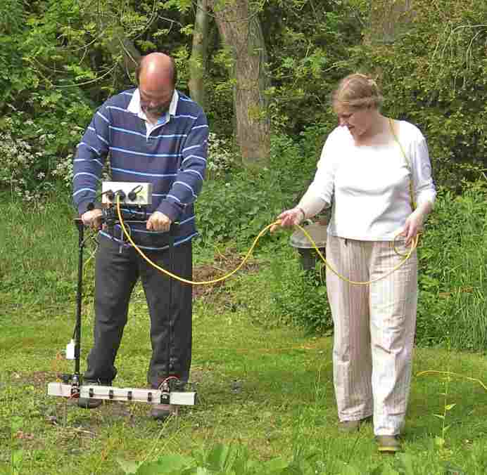
 Resistance survey is a form of geophysical survey where an electrical current is passed through the ground at regular points on a survey grid. Electrical resistance in the soil varies, and is affected by the presence of archaeological features. The patterns of resistance in the soil are recorded, plotted and interpreted.
Resistance survey uses a resistance meter, which is a square frame with two or four metal points (electrodes) projecting downwards, 50 or 100 centimetres apart along the base of the frame. These are inserted into the soil at every half or one metre and a brief pulse of weak electrical current is passed between them; the level of resistance (measured in ohms) is recorded on a data-logger; these readings are later downloaded onto a computer which uses a graphics programme to produce a map or plot of the resistance patterns across the survey area.
All electrical currents are subject to some level of resistance – this can be very low in the case of copper wire or water, or very high in the case of air, ceramics or stone. When an electrical current passes through the soil, it is conducted by mineral salts contained in water – therefore the amount of moisture content is essential to the level of resistance in the soil. The current does not jump in a single direct line between the positive and negative electrodes, but fans out to form a zone between them which can be several metres in depth depending on the quantity of electrical charge.
Buried archaeological features with varying moisture content such as ditches and pits (often higher moisture) and stone walls (often lower moisture) stand out compared to the soil around them – and can therefore be detected in the survey. Once the patterns of resistance are plotted, it is often very clear where walls or ditches exist, even though they are invisible from above ground. This information can be used to complement other geophysical data, for example from magnetometry, or to target the location of excavation trenches.


