The Project
The project aims to involve members of the local community in all aspects of archaeological research. Activities include:
Testpits

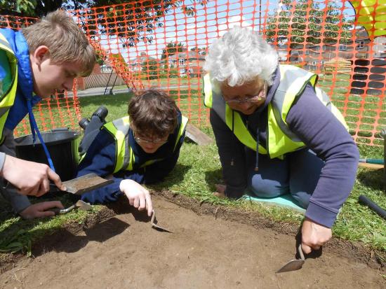
Archeox volunteers excavating a test pit in Littlemore, June 2013
Test pits are archaeological excavations in miniture. They are 1 metre by 1 metre excavations dug by hand in back gardens, allotments, playing fields - anywhere where the project is invited or can get permission. Individually test pits can tell us about the history of a particular location. However, cumulatively the results of multiple test pit excavations can tell us about broader patterns of past human activity across East Oxford, for example, the distribution of Roman or prehistoric activity. Test pits are also good for learning the skills needed for bigger archaeological excavations. Guide to test pit excavation
Excavations

Archeox volunteers excavating prehistoric features at Donnington Recreation Ground, October 2013
The project has run 2 large excavtions at Bartlemas Chapel and Minchery Farm, as well as a smaller excavation on Donnington Recreation Ground. Excavations allow us to understand in detail how specific sites have developed over time. Apart from sometimes using machines to do the initial removal of topsoil, all excavation is done by hand. Because excavation is a destructive process (you can't dig up the same place twice), we make detailed written, drawn and photographic records of all deposits, structures and artefacts that we find. Guide to excavation recording
Post-excavation analysis

Archeox volunteers sorting residues from environmental samples
The work of digging a test pit or a larger excavation is only the tip of the iceberg. Post excavation work includes inking drawings and pottery, finds washing, finds sorting, environmental sieving, environmental sorting, report writing, specialist reports on animal bone and pottery etc., finds photography and more. Guide to report writing
Geophysical Survey

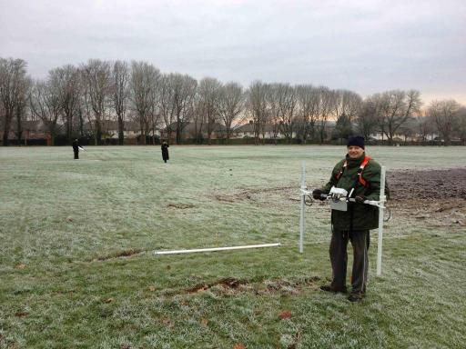
Archeox volunteers carrying out a gradiometer survey, winter 2012-13
The project uses two types of geophysical survey to rapidly understand past human activity in East Oxford's parks, playing fields and other greenspaces. Our gradiometer detects very slight distortions made to the earth's magnetic field caused by buried objects and features, some of which may be archaeological in origin. Gradiometer survey is good at quickly covering large areas but its results are often effected by buried iron objects (pipes, cables, fences) which can often be problematic in East Oxford. Our earth resistance meter can retect slight variations in soil moisture content which can often be cause by buried archaeology. Earth resistance survey is much slower than gradiometer survey but is good for adding detail to sites that you already know about. It is also uneffected by buried iron objects.
Place names research
A small group of volunteers is using old maps and documents to study place names in East Oxford. Old place names and field names can be used to reconstruct the landscapes and land use of the area in the past.


